Nidd Gorge
Bilton Banks Harrogate

Woodland Trust wood
45.98 ha (113.62 acres)
SE328579
Explorer 297
OS Landranger 104
Nidd Gorge woodland clings to a dramatic steep-sided valley. Its patchwork of habitats supports a wealth of wildlife and flora, including stunning bluebell displays in spring. Look out for relics of the site's intriguing history dating back to the Iron Age.
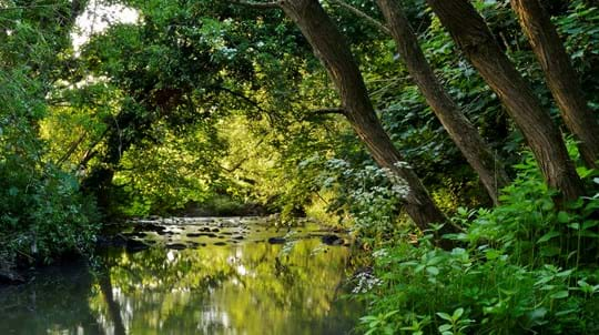
Stroll through the ancient, broadleaved woodland and along the banks of the gently meandering river in the sheltered depths of the valley, or climb higher for stunning views towards the historic spa towns of Knaresborough and Harrogate.
Features
- Parking at site
- Public access
How to get to Nidd Gorge
The 46-hectare (114-acre) Nidd Gorge wood is located in a steep-sided valley around 2km (1.5 miles) west of Knaresborough. The river Nidd runs east to west through the gorge, dividing the woodland into two equal parts.
Nidd Gorge is made up of five woods:
- Coalpits Wood
- Bilton Banks
- Spring Wood
- Scotton Banks
- Gates Wood
From the A1, take exit 47 onto the A59 towards Harrogate and York. Follow the A59 over one roundabout and at the second roundabout take the third exit to follow the A59. Continue into Knaresborough and onto High Street.
From High Street, take the B6165 towards Ripley. After around 2.4km (1.5 miles) you will find the car park just before Scotton Drive.
The nearest train station is Knaresborough.
Visit National Rail for more information.
The nearest bus stop is on Scotton Drive.
Visit Traveline for more information.
Facilities and access
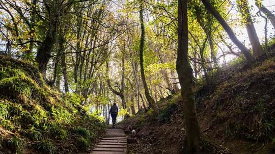
There is an information board near the main entrance showing the wood’s extensive footpath network. From the car park, a pedestrian gate leads to a well-surfaced forest track with some gentle inclines.
The track runs through the wood for around 1.1km (0.7 miles) to the river Nidd and connects with other paths which link with a network leading to Harrogate, Knaresborough and the surrounding area.
The Nidd Gorge site is steep in places. Paths may include steps and board walks, and it can be slippery in wet weather.
There is a pedestrian bridge across the river just off the forest track, about 300 metres from the car park.
To connect your walk to other Trust properties at Bilton Beck and Rudding Bottoms, follow the riverside path to the west (upstream) for around 1.5km (1 mile) from the bridge.
Walking guides, including the more adventurous Ripley Castle to Knaresborough Castle walk, can be found below in the things to do section.
There is a free onsite car park with space for 10 cars.
There are several public toilets in Knaresborough, including one at the entrance to the car park for Conyingham Hall. This is off the A59, near the bridge over the River Nidd.
Wildlife and habitats
Animals
The wood is brimming with wildlife – more than 80 species have been recorded. Look out for flocks of colourful blue tits, flame-headed goldcrests and little rosy-breasted redpolls. Near the river, you might spot a heron on the water’s edge or a flash of shimmering green as a kingfisher swoops low over the river.
Trees, plants and fungi
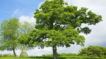
The southern bank of Nidd Gorge is designated semi-natural ancient woodland. The northern bank features lots of broadleaved woodland, as well as conifer stands which were planted in the 1960s. We are gradually thinning the conifers to allow more light into the wood and to encourage the broadleaf trees and native flora to regenerate.
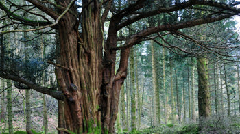
Trees along the river bank are mainly alder, but Bilton Banks contains several yew trees that are more than a century old.
Visit in the spring to discover a carpet of beautiful bluebells lighting up the forest floor.
Habitats
The valley woodlands and their surrounding agricultural land form part of the Nidd Gorge Project area, an enterprise set up by Harrogate Borough Council and Natural England to conserve and manage Nidd Gorge for its outstanding ecological and recreational value.
We bought the site in 1995 with the help of money raised by The Rambler's Association, Yorkshire Naturalist, town and parish councils, schools and Bilton Conservation Group. We also had help from the Heritage Memorial Fund and Harrogate Borough Council.
We bought a small extension in 2002.
History of Nidd Gorge
The gorge was sculpted by the River Nidd during the last Ice Age. There is a hillfort known as Gates Hill Camp around 60 metres above the river in the Scotton Banks section of the wood, which probably dates back to the Iron Age, though flints found on site suggest the site may have been used as a seasonal hunting camp earlier than this.
Traces of a defensive ditch with stone ramparts are still visible today. The site has been home to plenty of military activity over the years; finds of coins and munitions from the Civil War suggest that the wood was a base for Lord Fairfax’s Roundheads during the siege of Knaresborough Castle in 1644.

Credit: Mark Sunderland / WTML
Folklore
Jack Carter’s Cave near the riverbank is shown on ordnance survey maps, though there are no visible traces. Legend has it that a Civil War drummer hid in a cave in Nidd Gorge instead of leading troops to battle. The story has inspired a wooden seat carved with drumsticks.
Industry at Nidd Gorge
Records show that the wood dates back to at least 1600 and it has been used in the local industry through its history. There are records of coal deposits being worked in the 18th and 19th centuries. Coal was excavated by digging directly into exposed seams, creating bell-shaped pits. There are over 20 depressions where these pits once existed in Coalpits Wood, some as deep as six metres.
During the 1920s, some of the old oak woods on the southern bank of the Nidd were felled and much of the remainder was cleared during the Second World War by prisoners of war. The 1960s saw the planting of many conifers on the northern bank.
Things to do in Nidd Gorge

Visiting woods
Walking dogs in our woods
Dogs are welcome for walkies in our woods. Take a look at our tips and guidelines for ensuring we keep our woods safe and special for dogs and wildlife.

Visiting woods
Events
Discover events at our woods and the festivals and fairs you can find us at soon.

Visiting woods
Things to do in the woods
Go on an adventure. Get closer to nature. Uncover history. Discover ways to explore the UK's woods whatever the season.

A lasting legacy
This wood is just one of many to have been protected by gifts in wills, securing it for generations to come. Your legacy gift could also make a real difference to woods, trees and wildlife.
Learn what your gift could mean


