Hargate Forest
Tunbridge Wells
Woodland Trust wood


Size:
61.72 ha (152.51 acres)
Grid reference:
TQ574370
Map reference:
Explorer 135
OS Landranger 188
Hargate Forest was once part of one of the great medieval forests of the Sussex High Weald. Set in an Area of Outstanding Natural Beauty, it boasts mature woodland, an amazing diversity of plants and wildlife, an intriguing history and stunning views over the surrounding countryside.
Features
- Parking nearby
- Public access
How to get to Hargate Forest
Hargate Forest is a 61.7-hectare (152.5-acre) site at the southern edge of Tunbridge Wells on the Kent/East Sussex border. It is part of the High Weald, an Area of Outstanding Natural Beauty.
From Tunbridge Wells, head west along the A264 (Crescent Road) then turn left onto the A26 (London Road). At the roundabout, take the first exit onto the A267 (Nevill St). Continue for around 0.8km (0.5 miles) and then turn right on to Broadwater Down where you will find the entrance to the woods.
The nearest train station is Tunbridge Wells, around 3.2km (2 miles) from the wood.
Visit National Rail for more information.
The nearest bus stop is at the junction of Broadwater Down and Eridge Road, around 60 metres from the entrance to the wood. There is a regular bus service from the railway station and the town centre.
Visit Traveline for more information.
Facilities and access
The only official public entrance is from the south side of Broadwater Down, a residential street, around 60 metres east of the A26 Eridge Road. Entrance is via a metal RADAR kissing gate adjacent to double metal field gates. There is permissive access through the bunker area via a kissing gate on Broadwater Down, around 350 metres east of the main entrance.
The site has a good network of wide rides and smaller paths. The main entrance leads onto a wide ride, which is level and stone-surfaced for around 800 metres. Beyond the surfaced section, the rides are covered by grass, other vegetation or bare soil. There are some steep sections, and surfaces may be muddy in wet weather, with some sections waterlogged throughout the winter. There are other smaller paths which lead to more remote parts of the wood. These are steep in places and may be partly blocked.
There is no formal parking along the site, but there is space for a few cars along Broadwater Down.
The nearest public toilets are at Linden Park Road, The Pantiles, Tunbridge Wells, 1.6km (1 mile) away. There are disabled toilets, accessible with a RADAR key available from the tourist office in The Pantiles.
Wildlife and habitats
Animals
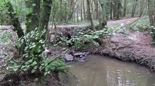
Fallow and roe deer have been recorded in the forest, and the pipistrelle bat has been seen near a pond in Montacute Field. You may also come across reptiles, including the grass snake, adder and common lizard. Amphibians include smooth, palmate and great crested newt and common toad.
There is also an abundance of birdlife. You might spot a sparrowhawk or be lucky enough to hear a nightjar.
Look out for:


Trees, plants and fungi
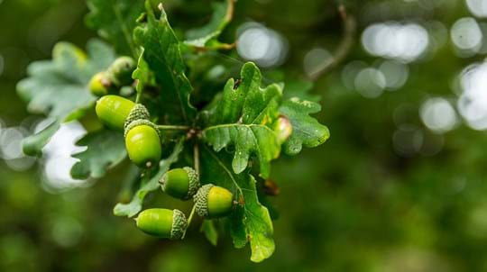
Hargate Forest has a mix of broadleaf woodland and conifer. Native trees include oak, birch, rowan, beech, holly, yew, and hazel. The southern part of the wood is largely broadleaved. Though the area isn’t designated as ancient woodland, it has characteristics of the habitat.
Look out for:


Habitats
Hargate Forest was once part of a larger forest that covered much of Tumbridge Wells. Much of it was planted with conifers in the 20th century.
Explore:


We acquired Hargate Forest in 1996 with help from Heritage Lottery Fund and the Friends of Hargate Forest. Since, we have been working to restore the woodland, its ponds and access.
About Hargate Forest
Hargate Forest is part of the Waterdown Forest that once covered much of the land from Tunbridge Wells to Wadhurst. From around 1500, it was part of the Eridge estate, the seat of the Earls of Abergavenny.
For centuries, the site was mainly woodland pasture grazed by sheep and cattle. However, maps dating from the late 18th century show much of the area as woodland.
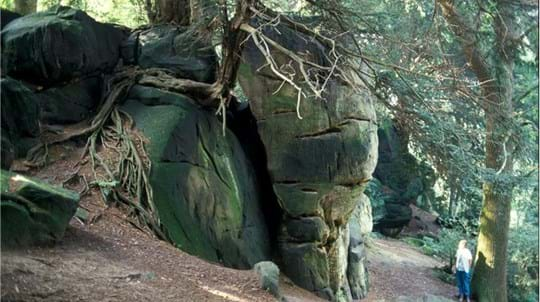
During the First World War, more than 16,000 trees were felled for the war effort. In the Second World War, the wood provided cover for the bunker dug into the top of Strawberry Hill in 1941 by the Tunnelling Company of the Royal Engineers. The tunnelling system is rumoured to have been dug as a secret headquarters, to be used in the event of an invasion. However, problems with flooding meant it was never used.
Things to do at Hargate Forest


A lasting legacy
This wood is just one of many to have been protected by gifts in wills, securing it for generations to come. Your legacy gift could also make a real difference to woods, trees and wildlife.
Learn what your gift could mean