Foulshiels
Stoneyburn
Woodland Trust wood


Size:
28.23 ha (69.76 acres)
Grid reference:
NS978633
Map reference:
Explorer 343
OS Landranger 65
Foulshiels Wood sits on the site of a restored coal mine at Stoneyburn, between Whitburn and West Calder. Planted with a mix of native and conifer trees in the 1980s, the bing is a prominent feature in the local landscape and is typical of the industrial heritage of this part of central Scotland. Thanks to a mix of soils and habitats, the wood is a great place to spot interesting plants in Spring.
Features
- Parking nearby
- Public access
- Grassland
How to get here
Foulshiels Wood is approximately 28 hectares (70 acres) in size and lies on the north side of the B7015, close to the town of Stoneyburn, West Lothian.
From Edinburgh head west along the A71 and join the M8 at Junction 1. Leave the M8 at Junction 4 and take the A801 slip road towards Falkirk/Bathgate/Whitburn. Turn left on to the A705, then right on to the B792, then turn right on to the B7015.
The nearest train stations are Addiewell (2.4km/1.5 miles) and West Calder (4.7km/3.6 miles).
Access and facilities
There are several paths running through and around the wood and neighbouring farmland. Some of them follow the branch lines of the old Wilsontown, Morningside and Coltness Railway.
There are four entrances to the wood, three leading from Stoneyburn and the fourth from an unclassified road to the north, via the route of the old mine railway.
All paths rise steeply to the summit, where you can enjoy views across the Almond Valley. At the heart of the wood is an open seating area.
Some paths are surfaced and some, especially those to the east, are not. Please be aware these paths can become muddy and waterlogged after heavy rain.
There is no formal car park but parking is permitted on Main St and there is a public car park next to RCA Garage Services in Stoneyburn which has space for 6 vehicles.
The nearest toilets are at Blackburn Mill Shopping Centre, Ash Grove, Blackburn, approximately 2.5km away. This includes accessible toilets which require a RADAR key.
Wildlife and habitats
Animals
Mixed woodland and a variety of interesting plants attract a range of wildlife to the wood.
Look out for:


Trees, plants and fungi
The mine at Foulshiels was abandoned in 1958 and most of the trees were planted in 1980.
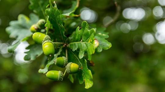
Whilst the woodland is relatively new, the mix of acid and base soils together with grassland and wetland creates an unusual mix of plants. A large variety of mosses are found in dense carpets on wetter ground, particularly to the north. You can expect to see plentiful lichens all year round and fungi in autumn, though there is little deadwood habitat.
Look out for:


Habitats
Foulshiels is predominantly mixed woodland with areas of open ground, seasonal open water, wet woodland and dense conifers. It is surrounded on all sides by farmland and lies in a mixed agricultural/urban landscape punctuated by small woodland, hedgerows and individual trees.
Lodgepole pine, the most common conifer species in Foulshiels, has been planted on the reshaped dome of the bing. Sitka spruce and larch can be found in the south east and occasional Scots pine throughout the wood.
Areas damaged by wind and fire are quickly recolonised by birch and willow which you can see at different ages throughout the wood.
Explore:


About Foulshiels
Several of the paths at Foulshiels follow the branch lines of the old Wilsontown, Morningside and Coltness Railway, which opened in 1845 and connected Morningside (near Wishaw) to Bathgate. It served the shale, oil and ironworks of the early Victorian era, including the shale colliery at Foulshiels. It also formed part of the passenger route between Edinburgh & Glasgow. In 1850 the return fare between the two cities was around 6 pennies in old money.
Mining at Foulshiels began in 1898. The main activity at the mine, including the railway, associated buildings, settling ponds and the bing, was centred largely along the old railway line. An aerial photograph taken of the site in 1955 appears to show that the other parts of the site were left as rough grazing or scrub woodland. The site was abandoned in 1958 and the two mine shafts filled and capped in the mid to late 1960’s. Their location is marked on site with straining posts.
The Foulshiels bing reclamation project commenced in 1980 and in December 1996 the Woodland Trust acquired the site on a 199-year lease from West Lothian Council. Since then we’ve installed drainage to improve wetter and damaged path sections, cleared and thinned some areas of conifer and replanted some areas with native species. In 2020 we plan to deliver extensive path improvement works to improve the visitor experience.
Things to do
The wood is a popular place for local people to enjoy walking and quiet recreation. The ‘Railway Route’ links Foulshiels with nearby Trust owned wood, Blaeberry where you can view prominent local landmark, ‘The Five Sisters Bings’.
Walking
There is a network of more than 4km of informal paths in the wood at Foulshiels including several circular routes. These link with the wider path network (Stoneyburn to Whitburn and Foulshiels to Blaeberry Wood) along the disused railway to the north and at the western boundary by the south western entrance. Routes are not waymarked and all rise towards the bing on the eastern side, climbing steeply to meet the summit with good views across the Almond Valley from certain points. At the heart of the wood is an open stone seating area.
Some paths are surfaced and some, especially those to the east, are not. Please be aware these paths can become muddy and waterlogged after heavy rain.

Visiting woods
Events
Discover events at our woods and the festivals and fairs you can find us at soon.

Visiting woods
Walking
Taking a walk in the woods is the easiest way to enjoy the outdoors and get closer to nature.

Visiting woods
Things to do in the woods
Go on an adventure. Get closer to nature. Uncover history. Discover ways to explore the UK's woods whatever the season.