Low Burnhall
Durham
Woodland Trust wood group
- Low Burnhall
- Low Burnhall ext 1


Size:
67.29 ha (166.27 acres)
Grid reference:
NZ266390
Map reference:
Explorer 308
OS Landranger 93
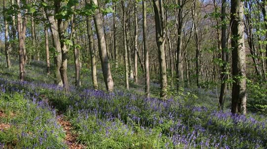
Low Burnhall is a patchwork of habitats. Gnarled, veteran, sweet chestnut trees in a block of ancient woodland contrast with areas of recent planting; wet woodland houses native amphibians; and the wildflower meadows attract clouds of butterflies in the summer.
This captivating woodland is a tranquil haven for people and wildlife, within easy reach of Durham city, and plays an important part in local history.
Features
- Parking at site
- Parking nearby
- Public access
- Spring flowers
- Waymarked walk
How to get to Low Burnhall
This 68-hectare (168-acre) woodland is located off the A167, part of the old Great North Road and just 3.2km (2 miles) south of Durham city centre.
It is bordered by the river Wear to the east and the river Browney to the south. Much of the wood falls within the Burn Hall Conservation area and is in an Area of High Landscape Value.
From Durham, head south-east on the A690 (Crossgate Peth), then, turn left onto the A167 (Darlington Road). At the Cock of the North roundabout, take the first exit onto the A177 (South Road). The car park is located immediately to your right.
The nearest train station is in Durham, 3.8km (2.4 miles) from the wood.
Visit National Rail for more information.
There are bus services from central Durham which stop on the A167, just south of the public footpath at Low Burnhall.
Visit Traveline for more information.
Facilities and access
The main entrance is through the car park just off the A177 (South Road). There are also five entrances from the A167 (Darlington Road). There is a network of maintained routes through the woodland with informal play areas, seats, willow sculptures, a bird hide and signposted walks.
A good network of paths, rides and open spaces have been created to allow visitors to wander freely across the site, as well as stroll along the riverside. There are also waymarked trails you can follow.
There is a free car park on site, with space for approximately 12 cars.
The nearest public toilets are in Durham city centre on Palace Green or on North Road.
Improving access for visitors
Watch our video about the new pathways and creation of a wildflower meadow. Funded with the help of the Biffa Award grant of £49,080, as part of the Landfill Communities Fund.
Wildlife and habitats
Animals
Low Burnhall and the surrounding areas are teeming with wildlife. Look out for signs of the otters which have been recorded in the River Wear that runs alongside the wood. Bird species to keep an eye (and ear) out for include kestrels, sparrowhawks and meadow pipits, as well as the more elusive tawny, barn and little owls.
Look out for:


Trees, plants and fungi
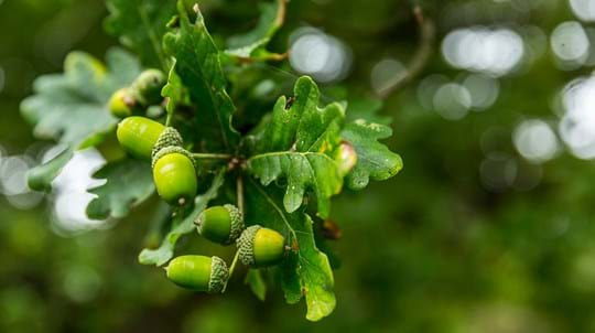
The 3.34-hectare Saltwell Gill Wood at the northern end of Low Burnhall is designated as ancient woodland and there are plenty of veteran trees to spot among the sessile oak and beech. Keep an eye out for locally rare species, such as small leaved lime and spindle.
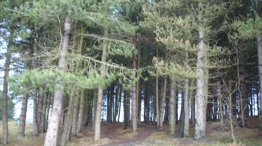
The recently planted areas at Low Burnhall have a wide range of native species, including ash, wild cherry and the rare native black poplar. The new plantations buffer and extend the ancient woodland, adding to a ribbon of woodland that runs down the western side of the Wear Valley.
Look out for:


Habitats
Saltwell Gill Wood in the north-east is designated a County Wildlife Site, and Low Burnhall contains a number of wetland habitats, such as the pond in the old clay pit, and wet grassland and woodland, which are home to frog, newt, toad, and water vole.
In addition to the woodland habitats, both natural and created, four wildflower meadows have been sown on the site, creating vibrant habitats for flora and fauna.
Explore:


We bought Low Burnhall Farm at auction in 2008. Over two years we planted almost 95,000 native trees across 61 hectares of the site. This buffers and extends the existing ancient woodland.
History of Low Burnhall
Low Burnhall sits between the 17th-century Croxdale Hall, the seat of the Salvin family, and Burn Hall, which dates from 1834 and was also once owned by the same family. The woodland was part of the Burn Hall Estate until 1926 when the hall was sold to a Roman Catholic mission.
The land was then used for a variety of industries and some areas were used for agriculture.

Credit: Daniel Romani / WTML
Coal mining and industry at Low Burnhall
Coal mining began with the opening of Croxdale pit in 1845, but it soon fell into disuse – probably because of poor coal quality. There was an engine house in the wood which powered a rope mechanism used to transport the coal along a wagon way, to the railway at the top of the hill. The wagon way route is still visible today, but all that remains of the engine house is what may have been the top of a boiler.
There was also a brick and tile works on the site in the 19th century and there is now a pond where the associated clay pit once was.

Dedicate at this wood
This wood is one of more than 50 across the UK where it's possible to dedicate trees, benches or larger areas of woodland. Mark a special occasion or celebrate the life of a loved one with a meaningful gesture that lasts.
Choose a dedicationThings to do in Low Burnhall
Walking
As you follow the wood’s waymarked trails, you will come across some interesting features.
There’s a sculpture of a miner, originally fashioned from willow tree but rebuilt using more durable oak and hazel – a nod to the coal mine that once existed on the site; a stone circle and stepping stones; a willow tunnel; a pond formed from an old clay pit; and a viewpoint with stunning vistas across County Durham. Look out for the sculptures in the woods carved by Jason Turpin-Thomson.
Or, extend your walk further. It’s possible to walk from Low Burnhall through adjacent woods and along the banks of the River Wear to Durham City or follow a shorter route northwards to Durham University Botanic Gardens. The Weardale Way, a 124km (77-mile) walk from Killhope in the North Pennines to the mouth of the river in Sunderland, runs just south of the wood.
Orienteering
Have a go at orienteering at Low Burnhall. There is a permanent orienteering course, set up in collaboration with orienteering club, the Northern Navigators. The course consists of 30 controls set out randomly over the site.


A lasting legacy
This wood is just one of many to have been protected by gifts in wills, securing it for generations to come. Your legacy gift could also make a real difference to woods, trees and wildlife.
Learn what your gift could mean