Glen Quey
Glendevon by Dollar Perthshire
Woodland Trust wood


Size:
382.96 ha (946.29 acres)
Grid reference:
NN971030
Map reference:
Explorer 366
OS Landranger 58
Glen Quey is one of three separate native woodlands that make up an area known collectively as Glen Devon Woodlands. Consisting of Glen Sherup, Geordie’s Wood and Glen Quey, together they stretch from Clackmannanshire to Perth and Kinross, with some of the best scenery that central Scotland has to offer.
With vast open spaces, high hilltops and spectacular views, a visit to Glen Quey is sure to be an unforgettable experience.
Features
- Parking nearby
- Public access
- Waymarked walk
- Grassland
- Moorland
- Broadleaved woodland
How to get to Glen Quey
The Glen Quey site sits in the middle of the two other Glen Devon Woodland sites. The sites are located in hill country in the central part of the Ochil Hills range. They are linked by the main A823 Dunfermline to Crieff road which runs through the glen and village of Glendevon.
The A823 Dunfermline to Crieff road passes through Glendevon and there are a number of points on the road where you can park. Please do not drive up the private, single track roads to the Glenquey and Lower Glendevon Reservoirs.
Access to Glen Quey is available by parking in the large lay-by on the main A823 beside Castlehill Reservoir and then joining the Reservoir Trail. Alternatively pedestrian access to Glen Quey is possible by parking in the village of Glendevon and taking the signed posted path to Bankfoot.
The nearest train stations are Gleneagles, around 15km (9.3 miles) from the wood and Alloa, 20km (12.4 miles) away.
Visit National Rail for more information.
The nearest bus stop is near the old toll house in Muckhart; 4km (2.5 miles) from Geordie’s Wood and then follow the Reservoir Trail through Geordie’s Wood until it connects with Glen Quey.
Visit Traveline for more information.
Facilities and access
There are two core paths passing through Glen Quey – the Reservoirs Trail and the Glen Quey Drove Road between Dollar and Glendevon is a core path.
There are also many informal paths to follow, most of which are entirely unsurfaced over grass and can be muddy in parts. Glen Quey walks range from gentle low ground with easy, mainly unmarked paths, to the higher hill tops with steep and exposed ground with no formal paths. Small burns are, in general, not bridged. Path surfaces are too soft for horses or bicycles with the exception of the Glen Quey drove road which, when dry in summer, would be suitable for both over most of its length.
The weather in the Scottish hills and glens can change quickly, so ensure you are properly equipped when you go walking and inform someone of your whereabouts before you set off.
There is a large car park on the main A823 through Glen Devon beside Castlehill Reservoir.
There are no public toilets within 8km (5 miles) of the site.
Wildlife and habitats
Animals
Glen Quey is full to the brim with rare and intriguing wildlife. Home to the red squirrel, the pine marten and the uncommon blaeberry bumblebee, there are lots of unusual species to look for here.
Look out for:


Trees, plants and fungi
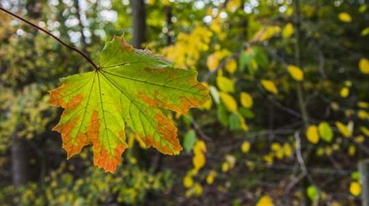
All three woods (Geordie’s Wood, Glen Quey and Glen Sherup) are predominantly made up of silver and downy birch, along with other broadleaves, including sessile and English oak, alder, willow and rowan.
Grassy areas are bright with wild flowers through spring and summer, including meadow buttercup, red campion, oxeye daisy and bird’s-foot trefoil, making these woods perfect for plant lovers.
Look out for:


Habitats
The mix of habitats, including open ground, grassland, natural and manmade watercourses, moorland and new native woodland, provides homes for a wide range of animal species.
Explore:


About Glen Quey
The main glens of Glendevon and Glenquey have a long history as stock routes, the Glen Quey drove road being part of one. The name of the wood is thought to relate to highlanders moving through the landscape as it may be a corruption of the Gaelic 'Glean Coimich' which means stranger's glen.

Credit: Laurie Campbell / WTML
Woodland creation
Long-term grazing on the site led to a loss in habitat diversity and wildlife until the Woodland Trust acquired it in 2000. We began planting trees in 2001 and 70% of the site was covered when we finished in 2002.
The planting was a part of a BP funded Scottish Forest Alliance project with the objective of regenerating native woodlands in Scotland.
Things to do at Glen Quey
Walking
Whether it’s a thirty-minute stroll or a five-hour hike, Glen Quey and the rest of the Glen Devon Woodlands offer a range of walking routes to suit everyone – from the easy 2km Castlehill Lower Loop walk to the more challenging 14km Reservoirs Trail. Just follow one of the waymarked routes.


Explore the Glen Devon Woodlands